Exploring the great outdoors is a wonderful adventure, but it comes with its own set of challenges, especially when it comes to navigating through rugged terrain. While smartphones and GPS devices offer convenience, they can fail when you're off the grid. That's where traditional navigation tools like maps and compasses come in handy. In this article, we'll delve into the art of reading maps and using a compass, essential skills for any outdoor enthusiast.
Understanding Topographic Maps:
Topographic maps are detailed representations of the Earth's surface, showing elevation changes, terrain features, water bodies, and landmarks. They use contour lines to depict elevation changes and symbols to represent various features such as trails, roads, and vegetation.
1. Scale and Legend:
- The scale indicates the relationship between distance on the map and distance on the ground. Understanding the scale helps you estimate distances accurately.
- The legend explains the symbols used on the map, such as contour lines, roads, rivers, and landmarks. Familiarize yourself with these symbols to interpret the map effectively.
2. Contour Lines:
- Contour lines connect points of equal elevation. By reading contour lines, you can discern the steepness of terrain, valleys, ridges, and peaks.
- Closer contour lines indicate steep terrain, while widely spaced lines represent gentle slopes.
3. Orientation:
- Always orient the map to match the direction you're facing. You can use landmarks or a compass to align the map correctly.
- Pay attention to northings (lines of longitude) and eastings (lines of latitude) to maintain proper orientation.
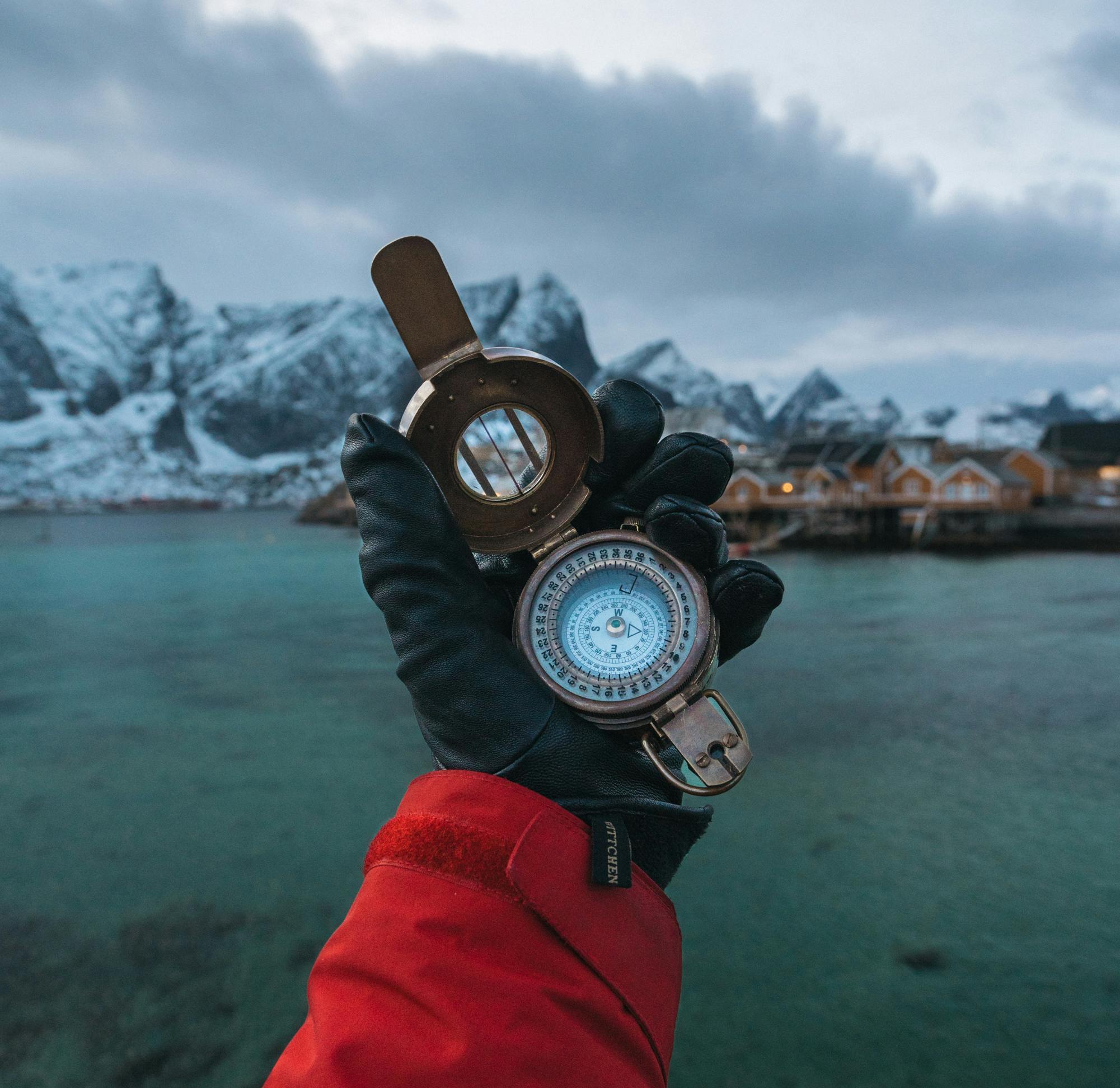
Using a Compass:
A compass is a fundamental tool for wilderness navigation, providing direction even when GPS devices fail. Learning to use a compass effectively can prevent you from getting lost in the wilderness.
1. Understanding the Compass:
- A compass consists of a magnetic needle that aligns with the Earth's magnetic field, pointing towards magnetic north.
- The housing of the compass contains degree markings, allowing you to determine your bearing or direction of travel.
2. Taking a Bearing:
- To take a bearing, hold the compass flat and steady, ensuring the needle is free to move. Rotate the compass housing until the orienting arrow aligns with the north-seeking arrow.
- Read the bearing indicated by the direction of travel arrow against the degree markings on the housing. This represents your desired direction.
3. Following a Bearing:
- To follow a bearing, keep the compass level and the direction of travel arrow pointing away from you. Rotate your body until the needle aligns with the orienting arrow, and then proceed in the direction indicated by the direction of travel arrow.
- Periodically check your compass to ensure you stay on course, especially in dense foliage or low visibility conditions.
Mastering the art of reading maps and using a compass is essential for safe and enjoyable outdoor adventures. While technology has its place, traditional navigation tools offer reliability and independence, ensuring you can navigate confidently even in remote areas. By understanding topographic maps and compass principles, you'll unlock the ability to explore nature's wonders with confidence and competence. Always be sure to carry supplies on your hikes to prepare for unexpected detours. Snake gaiters and trekking poles are great companions for any hike to ensure you're prepared for any terrain incase you find yourself going off the beaten path. So, next time you hit the trail, don't forget to pack your map and compass—it might just be the difference between a thrilling adventure and a lost trek in the wilderness.
Products Mentioned: